To properly display this page you need a browser with JavaScript support.
File Filename of the wireframe database . Supported formats:
wrf : proprietary format of TerrainBuilder tool.
Clear Remove the wireframe from the memory and scenario.
Layers List of all wireframes (layer) included into the database file (1).
User must select one to view coordinates and the associated texture skin.
When a layer is selected , the corner coordinates are updated (10,11)
When a layer is unchecked , it will not be displayed on the terrain map.
Read only for now. All modifications are lost.
Texture Texture file associated with the selected wireframe.
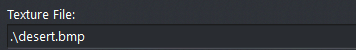
Mode Show here the representation mode of the selected layer:
WireMesh : single grid with a fixed number of meshes.
Quad-Tree : multiple grids where all meshes can be divided into 4 sub meshes, recursively.
A layer need to be selected into the list (1). Read only.
Temporary Hide If clicked, the texture mesh will be hidden .
A layer need to be selected into the list (1).
Automatic LoD If clicked, the number of meshed displayed will be computed according to the zoom level. This is only for speeding up the drawing process. Internally, the number of meshes is maximum and depends on the wire mesh definition.
A layer need to be selected into the list (1).
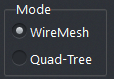
LOD Scale When Automatic LOD is not checked, use this slider to manually set the grid quality that will be kept whatever the zoom level.
A layer need to be selected into the list (1).
Coordinates Select the coordinate units for the displayed values of the corners (10 & 11).
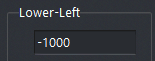
Lower-Left Coordinates of the bottom left corner of the wireframe database or just the selected layer in (1).
Upper-Right Coordinates of the top right corner of the wireframe database or just the selected layer in (1).
Bound Terrain Recalculate the terrain settings to match the wireframe (database) area (utter most corners).
Draw Filter In case of quad-tree wireframe, the mesh level will be chosen when the size of the inner mesh will be greater than the value set in this field.
The bigger the value, the more zoom will be requested before switching to higher definition (if any defined in the database).
Used for Altitude When this option is set (default), the Terrain will use this layer to get the altitude at a given position: function getAlt(WCoord);
If disabled, the altitude will be taken from another layer (if any) or return the global Z/Alt value set in Terrain Settings window.
Edit Surface Call the surface editor .
Hide If checked, the wireframe will not be displayed on the terrain map.