To properly display this page you need a browser with JavaScript support.
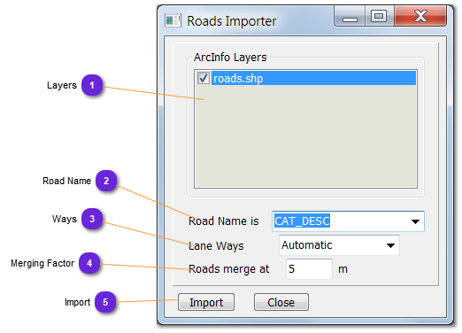
This importer need an Arc/Info database loaded in order to extract the roads from one or many layers and import them into vsTASKER.
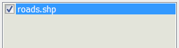
Layers List all the layers of the ArcInfo database loaded. Empty if not loaded.
Road Name For the selected Layer (above), all the categories are listed into this list-down menu.
Select the one to be considered for naming the roads with the content of the category.
If nothing is selected (Automatic), roads will be named "Road #x" with x a number.
Ways When Automatic is selected, the importer will try to guess the way for each segment found.
Otherwise, force each segment to be one-way or both-ways only.
Merging Factor Specify the minimum distance between two ArcInfo points to make a road break.
The shorter the value, the more complex will be imported roads, meaning, more memory and more CPU consumption for path-finding, but more accuracy also.
The bigger the value, the lesser the accuracy.
Import Click this button to import all roads based on the current setting.
Do not press it twice as all roads will be duplicated (with different names).
It is mandatory to fix the database after import. Do Tools::Fix Database and then save.