Prepare the terrain before use.
 Edit fieldName of the terrain layer.
|
|
 Edit field3D model file which will be loaded by the IG. Must be compatible with the selected IG.
|
|
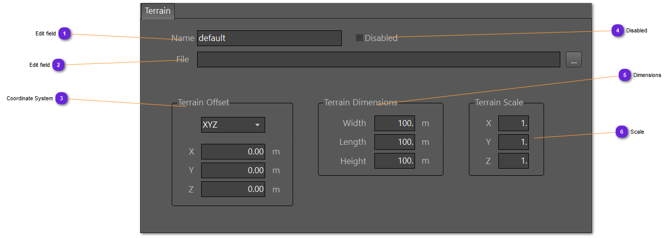
 Coordinate SystemSelect here the system to use to express the offset of the layer. The three field values must be according to the selected system.
-
-
: Earth Centered Earth Fixed system. -
: latitude, longitude, altitude, for WGS84 coordinates
|
|
 DisabledIf checked, the terrain will not be loaded.
This can be handy to avoid changing the definition of the database and just enable or disable some before loading the IG.
|
|
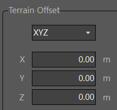
 DimensionsSet here the terrain dimensions (if known).
Will be useful in case no terrain is loaded and checker must be created for ground surface.
|
|
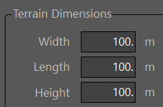
 ScaleUse these fields to expand or contract the terrain layer on the 3 axis.
For example, 2 on X and Y means the terrain will be 2 times bigger. 0.5 for two times smaller.
|
|