Copyright VirtualSim 2004-2020 - All rights reserved
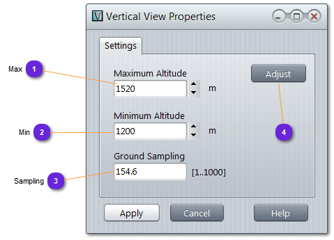
Vertical View
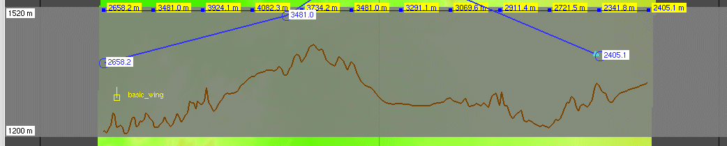
The vertical view displays a transparent panel on the terrain map to display the vertical terrain below a path or trajectory (when selected) or below entities.
Waypoint or Entity altitude are modifiable using the mouse, by selecting it and sliding the position up or down with the mouse button depressed.
Max
Maximum altitude to be displayed on the vertical view window (top).