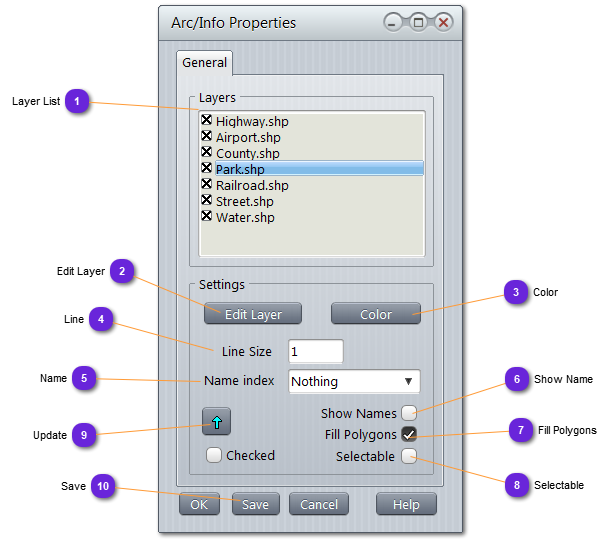
Layer ListList all layers imported from the original Arc/Info file.
Select one layer in order to activate the Settings block below.
When a layer is checked (x), it will be drawn on the map (visible). When unchecked, it will be hidden.
|
|
 Edit LayerCall the layer editor. See here.
|
|
 ColorSet the color to use to draw all lines of the selected layer.
|
|
 LineUse the text field to define the thickness of all lines of the selected layer.
|
|
 NameSelect from the list of attributes defined in the layer, which one to use as a label to display on the map.
|
|
 Show NameIf checked, names (5) are displayed on the map.
|
|
 Fill PolygonsIf checked, all polygons will be filled, otherwise, will be outlined.
|
|
 SelectableIf checked, the layer will be selectable with the mouse.
When a layer is selected, it will be drawn with double thickness.
|
|
 UpdateUse this button to update the selected layer with the changes applied in the settings block.
If Checked option is checked, update will apply for all checked layers of the list (1) and the selected one.
|
|
 SaveUse this button to overwrite the Arc/Info file with the updated settings (otherwise, changes will be lost when database is closed)
|
|